Map: III
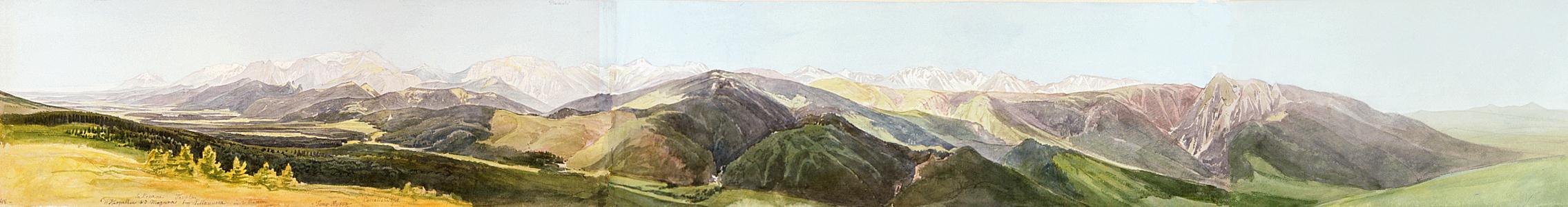
The Oravská Magura runs north-west of the Orava river valley. East of the Oravská Magura and the Orava, at the eastern fringes of the Skorušinské vrchy and south of Vitanová, there is a peak, which is also called Oravská Magura (1230 m). From there we can get a panoramic view of the mountains running from the east westwards. On the left we can observe the differences of altitude in the Tatras: above the green foothills we see the grey ranges of the Polish Tatras and above them, the main ridges of the High Tatras. In the extreme left, in the east, in the direction of Zakopane and Javorina, we see the Belianske Tatry from their narrow side. To the right of it, we find the High Tatras. There is an inscription signalling the sites of the Polska Tomanowa (1979 m) and the two valleys, Dolina Kościeliska and Dolina Chochołówska, that run behind the green ridges nearer to us. In the central section of the picture we see the Oravská Magura ranges and behind them, parts of the Liptovské Tatry, the Volovec (2065 m), the Baníkov (2176 m), etc., with the notched-peaked Sivý vrch (1806 m) on the extreme right. The nearer mountain to the right, whose one side is abrupt and the other is gently sloping, is the Osobitá (1687 m). The gorgeous Juranová dolina forks off from the valley that stretches below us. - Bibliography: Encyklopédia Slovenska, Kollár, Komarnicki, Šimko, Vysoké Tatry 1958. - For information on The High Tatras, see: