 Pencil, watercolour on paper, 294/299 x 466 mm
Map: (III)
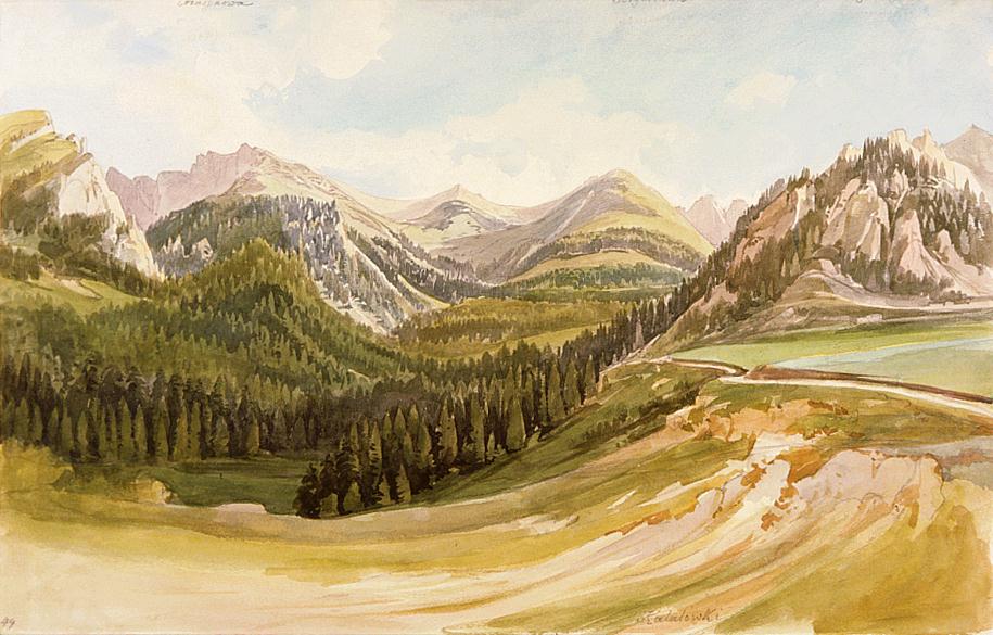
Polana Kalatówki has for a long time been a favourite tourist spot south of Zakopane, in the valley of the Bystre stream; it is found within easy reach of Kuznice. Our eyes are ranging over quiet valleys and crests as far as the ridge of the Western Tatras that border on the L'aliové sedlo / Liliowe (1952 m) in the east. The subsequent peaks seen here are the Kasprov vrch / Kasprowy Wierch (1985 m) on the left, the Goríčková / Czuba Goryczkowa (1913 m), which rises high right of the picture's midpoint (in accordance with the remains of the inscriptions along the upper edge), and the Giewont (1894 m) on the extreme right. (The word "Masynowa" on the upper right we have been unable to interpret.) - Bibliography: Kollár, Lazarek, Šimko, Vysoké Tatry 1976