 Pencil, watercolour on paper, 298 x 466 mm
Map: III
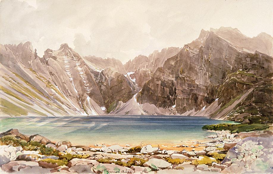
We see Czarny Staw pod Rysami in front of us. The precipice and peak of the Rysy we see from very close on the left. From the Polish side (where we are standing now) it is much more difficult to climb the peak than from the south, from Poprad Lake in Mengusovská dolina. The natural rock barrier separating Czarny Staw pod Rysami and Morskie Oko is now to be found behind us. - Czarny Staw pod Rysami / Tengerszem / Meerauge is located above Morskie Oko at a height of 1580 m. It stretches over 20.6 hectares and is 76 m deep at its deepest. The two lakes are separated by a high precipice. We ought not to be confused by the designations of the lakes in different languages: in Polish, it is the lower lake that we call a tarn ("morskie oko"), however, in Hungarian and German it is the upper one ("tengerszem" and "Meerauge"). The Rysy (2499 m) is the highest peak in Poland; it rises above Czarny Staw on the border between Poland and Slovakia. - Bibliography: Halas-tó, Kollár, Šimko, Vysoké Tatry 1976