 Pencil, watercolour on paper, 354 x 542 mm
Map: III
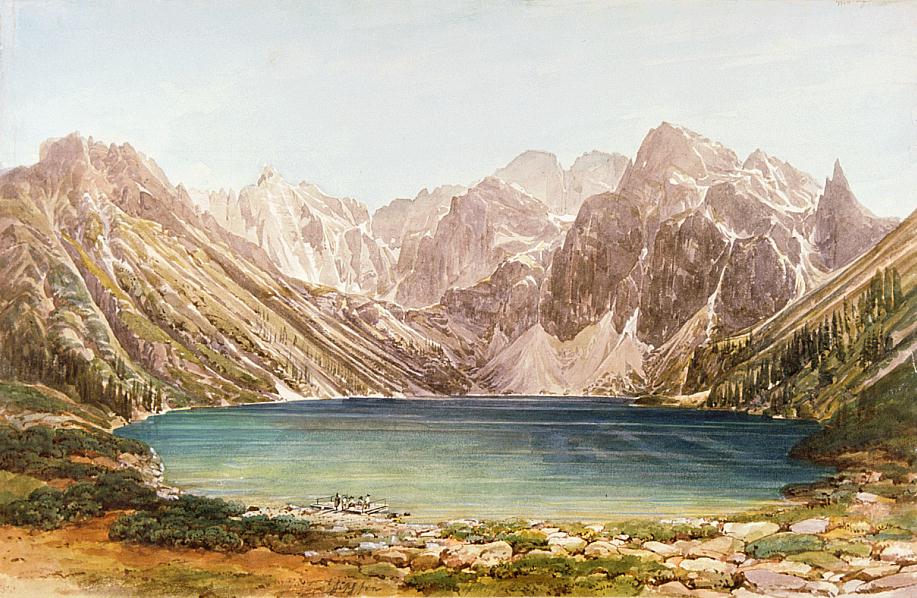
Above the opposite shore of the Morskie Oko, we see a natural rock barrier behind which we find the Czarny Staw pod Rysami and, above it, the precipice of the Rysy to the left. On the extreme right, we see the needle of the Mnich (= monk) (2068 m), which is associated with a local legend. On this shore of the lake we see a small group of people standing on a landing-stage. - Today Morskie Oko / Halas-tó / Fischsee belongs to the territory of Poland - at the time of Ender's visit it was part of Galicia, which in turn was part of the Austrian-Hungarian Monarchy - at a height of 1393 m (1406 m) above sea level. With its area of 34.5 hectares, it is the largest lake in the High Tatras. In German and Hungarian it was named after its rich population of trout. High rocky mountains that rise above 2000 m enclose the lake, whose maximum depth is 51 m. - Bibliography: Halas-tó, Kollár, Komarnicki, Lenkei, Šimko, Vysoké Tatry 1976